Rotterdam Maps and Orientation
(Rotterdam, South Holland, Netherlands)
The Dutch city of Rotterdam is vast and spreading, being divided in no small part by the shipping canal, which is known locally as the Nieuwe Maas. This prominent waterway is spanned by a number of bridges and tunnels, meaning that all parts of Rotterdam are easy to reach.
The reconstructed city centre lies on the northern banks of the Nieuwe Maas, while to the south you will find enormous neighbourhoods, urban developments and residential areas. In general, most visitors find it fairly difficult to lose their way in Rotterdam, since so many of the buildings have become distinctive and easily recognised landmarks in their own right.
Maps and Orientation of the City
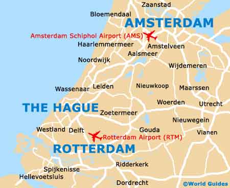
Rotterdam spreads over a large part of South Holland (Zuid Holland), where it is the region's biggest and most prominent city. The commercial centre of Rotterdam is located on the eastern side of the city, while the majority of the museums are located to the west. Those looking for the historical district of Delfshaven should head around 3 km / 2 miles further west.
Maps of Rotterdam are always worth obtaining and can be found at the Donner bookshop along the Lijnbaan, and also at the Tourist Office, which is located on the Coolsingel and shares the same building as the Dutch automobile association ANWB.
- Alkmaar - 96 km / 60 miles (one hour and 20 minutes, north)
- Amsterdam - 74 km / 46 miles (one hour and ten minutes, north)
- Biesbosch National Park - 59 km / 37 miles (55 minutes, east)
- Breda - 50 km / 31 miles (45 minutes, south)
- Dordrecht - 25 km / 16 miles (30 minutes, south-east)
- Eindhoven - 113 km / 70 miles (one hour and 30 minutes, south-east)
- Haarlem (Haarlemmermeer) - 72 km / 45 miles (one hour and ten minutes, north)
- Kinderdijk - 26 km / 16 miles (35 minutes, south-east)
- Nijmegen - 115 km / 71 miles (one hour and 30 minutes, east)
- Oss - 98 km / 61 miles (one hour and 20 minutes, east)
- Roosendaal - 63 km / 39 miles (one hour, south)
- The Hague (Den Haag) - 25 km / 16 miles (22 minutes, north-west)
- Tilburg - 80 km / 50 miles (one hour and 15 minutes, south-east)
- Utrecht - 60 km / 37 miles (one hour, north-east)
- Westland - 26 km / 16 miles (30 minutes, north-west)
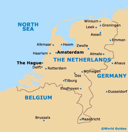
Map of The Netherlands
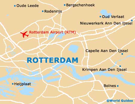
Map of Rotterdam